Category:Stapleford, Wiltshire
Jump to navigation
Jump to search
village and civil parish in Wiltshire, UK  | |||||
| Upload media | |||||
| Instance of | |||||
|---|---|---|---|---|---|
| Location | Wiltshire, South West England, England | ||||
 | |||||
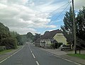
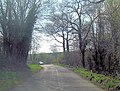
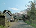
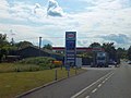
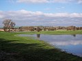
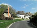
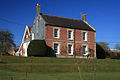
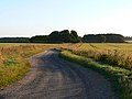
English: Stapleford is a small village located in Wiltshire, in England. It lies around 7 km north-west of Wilton, and is located on the River Till, near to its confluence with the River Wylye. The A36 road passes through the village and includes a sharp 90° bend at its junction with the B3083. This bend is situated at the bottom of an incline in the road, so drivers must take care when negotiating it. The population of Stapleford in 2001 was 265..
Subcategories
This category has only the following subcategory.
Media in category "Stapleford, Wiltshire"
The following 108 files are in this category, out of 108 total.
-
 A36 passes Esso service station - geograph.org.uk - 3461289.jpg 3,648 × 2,736; 1.85 MB
-
 A36 passes The Pelican - geograph.org.uk - 4011658.jpg 3,478 × 2,661; 1.23 MB
-
 B3083 at Stapleford - geograph.org.uk - 4816496.jpg 640 × 427; 96 KB
-
 B3083 enters Stapleford - geograph.org.uk - 3461267.jpg 3,032 × 2,291; 1.89 MB
-
 B3083 in Stapleford - geograph.org.uk - 3461226.jpg 3,208 × 2,516; 1.46 MB
-
 B3083 junction with the A36 - geograph.org.uk - 3461283.jpg 3,217 × 2,534; 1.78 MB
-
 B3083 passes Wiltshire Girl Guide Headquarters - geograph.org.uk - 3461220.jpg 3,384 × 2,588; 1.4 MB
-
 Beehives, Stapleford - geograph.org.uk - 2281705.jpg 640 × 481; 98 KB
-
 Bench Mark, Pelican Bridge - geograph.org.uk - 2281736.jpg 480 × 640; 78 KB
-
 Bridleway approaching Stapleford - geograph.org.uk - 1623619.jpg 640 × 480; 92 KB
-

-
 Business open as usual, Stapleford - geograph.org.uk - 2281762.jpg 640 × 480; 75 KB
-
 Chain Hill in Stapleford - geograph.org.uk - 5319628.jpg 4,000 × 3,000; 3.49 MB
-
 Church Gate from St Mary's Porch - geograph.org.uk - 333485.jpg 640 × 480; 150 KB
-
 Cottages at Stapleford - geograph.org.uk - 1623797.jpg 640 × 410; 57 KB
-
 Druid's Head Farm - geograph.org.uk - 6279599.jpg 800 × 533; 143 KB
-
 Electricity sub station, Serrington - geograph.org.uk - 372226.jpg 640 × 480; 145 KB
-
 Esso filling station on A36 at Stapleford - geograph.org.uk - 3576642.jpg 1,024 × 770; 115 KB
-
 Farm buildings, Stapleford - geograph.org.uk - 1623647.jpg 640 × 480; 105 KB
-
 First Broad Drive - geograph.org.uk - 294039.jpg 640 × 414; 162 KB
-
 Flooding in the Wylye Valley - geograph.org.uk - 326989.jpg 640 × 480; 62 KB
-
 Fog at Druid's Head Farm - geograph.org.uk - 1622664.jpg 640 × 480; 63 KB
-
 Footpath, Stapleford - geograph.org.uk - 2281752.jpg 480 × 640; 142 KB
-
 Former garage, Druid's Lodge - geograph.org.uk - 1622393.jpg 640 × 480; 97 KB
-
 Grade II listed cottages in Stapleford - geograph.org.uk - 3461301.jpg 3,648 × 2,736; 2.05 MB
-
 Hens in field at Stapleford - geograph.org.uk - 4816494.jpg 640 × 427; 105 KB
-
 Inside St Mary, Stapleford (A) - geograph.org.uk - 5083455.jpg 480 × 640; 35 KB
-
 Inside St Mary, Stapleford (B) - geograph.org.uk - 5083459.jpg 480 × 640; 65 KB
-
 Inside St Mary, Stapleford (C) - geograph.org.uk - 5083460.jpg 640 × 480; 66 KB
-
 Inside St Mary, Stapleford (D) - geograph.org.uk - 5083462.jpg 640 × 480; 75 KB
-
 Manor Farmhouse - Stapleford - geograph.org.uk - 686499.jpg 640 × 427; 113 KB
-
 Ordnance Survey Flush Bracket S8369 - geograph.org.uk - 5319620.jpg 4,000 × 3,000; 3.83 MB
-
 Over Street, Stapleford - geograph.org.uk - 372242.jpg 640 × 480; 136 KB
-
 Pelican Bridge, Stapleford - geograph.org.uk - 2281727.jpg 640 × 480; 60 KB
-
 Plaque, Pelican Bridge - geograph.org.uk - 2281774.jpg 640 × 481; 79 KB
-
-

-

-
 River Till at Stapleford - geograph.org.uk - 1623789.jpg 640 × 480; 88 KB
-
 River Till, Stapleford - geograph.org.uk - 2281715.jpg 640 × 480; 72 KB
-
 Rush hour in Stapleford - geograph.org.uk - 5083188.jpg 640 × 480; 82 KB
-
 Salisbury District , The A36 Road - geograph.org.uk - 3126569.jpg 4,166 × 2,652; 5.84 MB
-
 Serrington , Esso Petrol Station - geograph.org.uk - 3105287.jpg 4,288 × 2,848; 5.37 MB
-
 Serrington , The A36 - geograph.org.uk - 3105283.jpg 4,288 × 2,848; 5.21 MB
-
 Sign for the Pelican Inn, Stapleford - geograph.org.uk - 948840.jpg 480 × 640; 68 KB
-
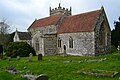 St Mary's Church, Stapleford - geograph.org.uk - 4816492.jpg 640 × 427; 82 KB
-
 St Mary's church, Stapleford - geograph.org.uk - 6256630.jpg 2,592 × 1,944; 1.77 MB
-
 St Mary, Stapleford, altar - geograph.org.uk - 5083521.jpg 640 × 480; 74 KB
-
 St Mary, Stapleford, churchyard (A) - geograph.org.uk - 5083452.jpg 640 × 480; 82 KB
-
 St Mary, Stapleford, churchyard (B) - geograph.org.uk - 5083453.jpg 480 × 640; 152 KB
-
 St Mary, Stapleford, churchyard (C) - geograph.org.uk - 5083454.jpg 640 × 480; 125 KB
-
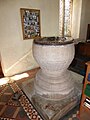 St Mary, Stapleford, font - geograph.org.uk - 5083523.jpg 480 × 640; 60 KB
-
-
 St Mary, Stapleford, lectern - geograph.org.uk - 5083527.jpg 480 × 640; 71 KB
-
 St Mary, Stapleford, memorial (A) - geograph.org.uk - 5083480.jpg 640 × 480; 67 KB
-
 St Mary, Stapleford, memorial (B) - geograph.org.uk - 5083463.jpg 640 × 480; 83 KB
-
 St Mary, Stapleford, memorial (C) - geograph.org.uk - 5083504.jpg 640 × 480; 108 KB
-
 St Mary, Stapleford, memorial (D) - geograph.org.uk - 5083506.jpg 640 × 480; 111 KB
-
 St Mary, Stapleford, memorial (E) - geograph.org.uk - 5083507.jpg 640 × 480; 96 KB
-
 St Mary, Stapleford, memorial (F) - geograph.org.uk - 5083501.jpg 640 × 480; 60 KB
-
 St Mary, Stapleford, mid August 2016 - geograph.org.uk - 5081103.jpg 640 × 480; 92 KB
-
 St Mary, Stapleford, organ - geograph.org.uk - 5083525.jpg 480 × 640; 53 KB
-
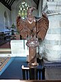
 St Mary, Stapleford, pulpit - geograph.org.uk - 5083526.jpg 640 × 480; 48 KB
-
 St Mary, Stapleford, south door - geograph.org.uk - 5083456.jpg 480 × 640; 53 KB
-

-

-

-

-
 Stapleford houses (1) (geograph 7348636).jpg 4,320 × 3,240; 2.92 MB
-
 Stapleford houses (10) (geograph 7349299).jpg 4,320 × 3,240; 2.14 MB
-
 Stapleford houses (13) (geograph 7349305).jpg 4,320 × 3,240; 2.49 MB
-
 Stapleford houses (14) (geograph 7349967).jpg 4,310 × 3,232; 2.72 MB
-
 Stapleford houses (15) (geograph 7349968).jpg 4,300 × 3,225; 2.48 MB
-
 Stapleford houses (16) (geograph 7349969).jpg 4,320 × 3,240; 3.29 MB
-
 Stapleford houses (17) (geograph 7349971).jpg 4,320 × 3,240; 2 MB
-
 Stapleford houses (3) (geograph 7349279).jpg 4,290 × 3,218; 2.74 MB
-
 Stapleford houses (6) (geograph 7349282).jpg 4,320 × 3,240; 2.64 MB
-
 Stapleford houses (7) (geograph 7349283).jpg 4,320 × 3,240; 2.99 MB
-
 Stapleford houses (8) (geograph 7349285).jpg 4,261 × 3,196; 3.12 MB
-
 Stapleford houses (9) (geograph 7349298).jpg 4,320 × 3,240; 2.14 MB
-

-
 Sunrise over Henry's Plantation - geograph.org.uk - 5645473.jpg 2,344 × 1,258; 93 KB
-
 Thatched Cottage, Stapleford - geograph.org.uk - 948855.jpg 640 × 466; 96 KB
-
 Thatching in progress at Stapleford - geograph.org.uk - 333421.jpg 640 × 480; 164 KB
-
 The Pelican Inn, Stapleford - geograph.org.uk - 372211.jpg 640 × 480; 80 KB
-
 The River Wylye at Stapleford - geograph.org.uk - 5267481.jpg 2,048 × 1,536; 2.55 MB
-
 The Street at Stapleford - geograph.org.uk - 84133.jpg 640 × 480; 65 KB
-
 Trees at Stapleford - geograph.org.uk - 1623784.jpg 480 × 640; 122 KB
-
 Victorian Bier - geograph.org.uk - 333461.jpg 640 × 480; 136 KB
-
 Village scene, Stapleford - geograph.org.uk - 1101304.jpg 640 × 484; 119 KB
-
 Weather vane, Stapleford - geograph.org.uk - 948859.jpg 640 × 524; 40 KB
-
 Wheat field, near Stapleford, Wiltshire - geograph.org.uk - 871896.jpg 640 × 480; 118 KB
-

-
 Ashburton, Over Street, Stapleford - geograph.org.uk - 333555.jpg 640 × 480; 80 KB
-
 Barford Down - geograph.org.uk - 480077.jpg 640 × 480; 164 KB
-
 Barley, Little Wishford - geograph.org.uk - 489550.jpg 640 × 480; 144 KB
-
 Brooklet Farm, Stapleford - geograph.org.uk - 333557.jpg 640 × 480; 69 KB
-
 Byway, Stapleford - geograph.org.uk - 372248.jpg 640 × 480; 176 KB
-
 Down and farmland, Great Wishford - geograph.org.uk - 484531.jpg 640 × 480; 132 KB
-
 Downland, Great Wishford - geograph.org.uk - 480071.jpg 640 × 480; 152 KB
-
 Downland, Great Wishford - geograph.org.uk - 480078.jpg 640 × 480; 134 KB
-
 Downland, Great Wishford - geograph.org.uk - 480081.jpg 640 × 480; 141 KB
-
 Downland, Great Wishford - geograph.org.uk - 484452.jpg 640 × 480; 159 KB
-
 Downland, Great Wishford - geograph.org.uk - 484468.jpg 640 × 480; 162 KB
-
 Downland, Great Wishford - geograph.org.uk - 484557.jpg 640 × 480; 175 KB
-
 Farm track, Druid's Head Farm - geograph.org.uk - 489451.jpg 640 × 480; 151 KB
-
 Farmland, Druid's Head - geograph.org.uk - 490562.jpg 640 × 480; 159 KB
-
 Pines on Hadden Hill - geograph.org.uk - 484550.jpg 480 × 640; 131 KB


_-_geograph.org.uk_-_5083455.jpg)
_-_geograph.org.uk_-_5083459.jpg)
_-_geograph.org.uk_-_5083460.jpg)
_-_geograph.org.uk_-_5083462.jpg)


_-_geograph.org.uk_-_5083452.jpg)
_-_geograph.org.uk_-_5083453.jpg)
_-_geograph.org.uk_-_5083454.jpg)


_-_geograph.org.uk_-_5083480.jpg)
_-_geograph.org.uk_-_5083463.jpg)
_-_geograph.org.uk_-_5083504.jpg)
_-_geograph.org.uk_-_5083506.jpg)
_-_geograph.org.uk_-_5083507.jpg)
_-_geograph.org.uk_-_5083501.jpg)


_-_geograph.org.uk_-_5083512.jpg)
_-_geograph.org.uk_-_5083514.jpg)
_-_geograph.org.uk_-_5083516.jpg)
_-_geograph.org.uk_-_5083520.jpg)
_(geograph_7348636).jpg)
_(geograph_7349299).jpg)
_(geograph_7349305).jpg)
_(geograph_7349967).jpg)
_(geograph_7349968).jpg)
_(geograph_7349969).jpg)
_(geograph_7349971).jpg)
_(geograph_7349279).jpg)
_(geograph_7349282).jpg)
_(geograph_7349283).jpg)
_(geograph_7349285).jpg)
_(geograph_7349298).jpg)


